
"What's your biggest red flag in a partner?"
The Wisest Admit When They've Made A Mistake...
"Inability to recognize or admit when they've made a mistake."- UniversityEastern542
My Way Or The Highway...
"Using ultimatums to get their way instead of compromising."- Whed1956
And That Concerns Me, Why?...
"No respect for your interests or your time."- ElNakedo·
 Bored Over It GIFGiphy
It's Can Be Easy To See Clearly Through The "Gaslight"...
"Manipulation on any level."- xfalinex
"Manipulating, gaslighting, 'winning'."- umbrex
Is It Really So Difficult To Say "I'm Sorry"?...
"Inability to apologize."- theregoesthevillage
 Sorry Taylor Swift GIFGiphy
Honesty is ALWAYS The Best Policy...
"My biggest red flag in a partner would be their inability to communicate effectively and be honest with me."
"Trust is key."- Proper_Ad5123
What You See Is What You Get
"Wanting to change my style and look."
"First girlfriend wanted me to wear button up shirts, colored my hair brown, and even wanted me to wear brown colored contact lenses."
"Coincidentally these were all features of her cousin who she later married."
"A good partner helps you grow and become the best version of you."
"They don't try to mould you into their own vision."- AdmiralClover
 Alicia Silverstone Makeover GIF by filmeditor
Written In The Stars
"Blames their sh*tty behaviour on their star sign."
"Yeah, I ain't buying the 'it's because I'm a Scorpio" bullsh*t."- A_Direwolf
...Or Maybe A Scratched Cornea?
"An eyepatch. It's a sign of dangerous living, possibly pirate or rustler but certainly an outlaw."- beathelas

Temper Temper...
"Can't control their anger and/or hits and breaks stuff when angry."- LilleSmurfine
There Is Nothing More Important In Life...
"Your significant other restricting you from hanging out with your friends."- AagamAaghnya
There Is So Much More To Life...
"If their political views are their whole personality."- V1p3rzach
 brooklyn nine nine politics GIFGiphy
It's fair enough to have deal breakers when it comes to finding a partner.
Always remember though, first impressions can be misleading.
And love has a way of helping you overlook the imperfections of others.


When we think of children's movies, we may think of harmless fun.
But that doesn't mean there isn't some seriously messed up content in those films.
Like ever notice at least one parent is almost always dead—or dies!—during every Disney animated film?
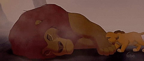
Don't even get us started on Old Yeller.
Anyway...
Redditor Inflatabledartboard4 was curious about others' childhood cinematic trauma and asked:
"What is the most f**ked up kids' movie?"
All Dogs Go to Heaven
"Our hero is released from prison, only to be MURDERED by his former boss via vehicular homicide. Then that dog eventually winds up being continuously tortured by demon dogs in Hell."
"The giant demon dog filling the town with blood red smoke at the end is some pretty terrifying imagery."
‐ Diwari
 Giphy
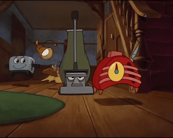
GiphyBrave Little Toaster
"Suicide and abandonment all around."
- SkuzzleJR
"The air conditioner haunted my nightmares."
- Longjumping_Fold_369
"For some reason the part when the vacuum tried to eat its cord really freaked me out as a kid."
- ThoriatedFlash
"There’s a lot of scary stuff in that movie but the flower might be the worst."
"I remember feeling like, despair for the first time as a child seeing that."
- purplefirefly6102
"The blender getting killed onscreen. I first saw Brave Little Toaster when I was around six, but I knew from the atmosphere of that scene what was really going on when you see the shadow of that wire getting cut."
"I was kind of horrified, and the the very next scene is another customer coming in asking for radio tubes and Radio is put on the chopping table but survives at the last second."
- EeSeeZee
 Giphy
GiphyMonster House
"The movie is literally about a man living in a house possessed by his dead wife and the house literally eats living creatures so I'd say that's what f**ked me up as a kid."
- Supa_saint
"Not just that, the dead wife was a circus freak and hated kids because they would always taunt her. So they move into this house and she dies."
"The husband who actually loves kids, now has to keep everyone away from the house or his wife will kill them."
"And then at the end the husband has to kill his wife aka the house."
"Too f**ked up for a kids' movie."
- whskid2005
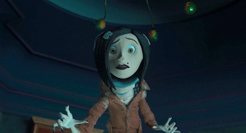
Coraline
"Coraline scares me so much more as an adult than it ever did when I was a kid."
"I still love the movie and watch it several times a year, but somewhere between childhood and adulthood I got way more scared of dolls and puppets and sh*t, and I don’t actually know why."
"Like nothing happened to make them scarier."
- Writing_Nearby
"I loved Coraline as a kid. I still do!"
"And the books are actual nightmare fuel, but I highly recommend giving them a read because the lore is really interesting and the story is different."
- SimplyAurallz
 Giphy
GiphyPinocchio - Disney animated version
"I'm surprised I was never traumatisedby Disney's Pinocchio as a child, because watching it as an adult, there are moments that are straight up nightmare fuel."
- neohylanmay
"When the boy who is with Pinocchio turns into a donkey, he cries out for his mother. I can’t."
- MLAheading
"Ugh, watched it for the first time with my partner and two kids, during that scene all I could do is look at the two kids and wonder how they were not crying while I was on the brink of tears..."
- NurseJessisStressed
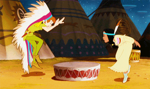
Peter Pan - Disney animated version
"The racism in Disney's animated Peter Pan is pretty f**ked up."
"Princess Tiger Lily and the song 'What Made the Red Man Red?' is just gross if you're an Indigenous kid watching it."
- LakotaGrl
 Giphy
GiphyThe Cat In The Hat
"The Cat in the Hat is something out of a back rooms nightmare in my opinion."
- hbombgomer12
"I literally just watched this, and I’m still questioning if I actually saw a movie, or just tripped out for 2 hours."
- LaMorak1701
The Last Unicorn
"Is The Last Unicorn even a kids movie? It's super scary."
"BTW I loved it as a kid and I still do. The whole Mommy Fortuna part was really dark, though."
- horschdhorschd
"I watched it in the last couple years. I never understood Molly Grue’s meltdown at realizing she was with a unicorn. That scene hit hard as an adult. Missing out on the things you wanted in your youth only for opportunities to come by too late. I cried."
- cats_and_vibrators
"Super scary and way more sexual than I remember from when I was a kid."
- lovemyneighbor
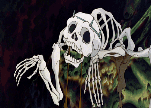 The Last Unicorn Skeleton GIF by MauditGiphy
The Fox And The Hound
"The Fox and the Hound. Still traumatized to this day."
- asayle88
"That move absolutely wrecked me as a child, and I refuse to watch it ever again."
- droopingcactus25
"My best friend and I wept in that movie."
- CraftyRole4567
E.T.
"E.T. The scene where Elliott watches E.T. die is all kinds of traumatizing. Never mind the Christlike resurrection afterward, the damage is still done."
- Brilliant_Tourist400
"The bit where the kids find him in the ditch looking like a piece of fine Italian deli meat.."
"Also the feds in biohazard suits crashing through the kid's house scared the f**k out of me at 7 years old"
- feeb75
"Having your home invaded is terrifying enough....seeing it through the eyes of the kids and the mother screaming 'This is my home!' Sends chills down my spine."
- LaCroixBoy89
 Sci-Fi Movie GIF by MANGOTEETHGiphy
Where The Red Fern Grows
"Where the red fern grows. My grade 5 teacher made us read it then watch it. I remember thinking she was an absolute b*tch before the movie. As an adult I’m 100% sure she hated children."
- DesperateFunction179
"My 5th grade teacher made us read the book and watch the movie too. She cried during the end of both."
- BadBackNine
"I read and watched this in 5th grade also. Shudder sobbed through most of it. Added it to my list of things that made me an overly empathetic adult"
- maiden-of-might
Dumbo — Disney animated version
"Dumbo. The animal abuse, neglect, and let's not forget the 'Elephants on Parade' scene when Dumbo gets drunk. Have not been able to watch this movie as an adult."
- ArtisanalMagi
"I have a friend who made the mistake of showing it to a kid she was babysitting overnight. The moment the Baby Mine scene came up the kid was done. I think the night was unsalvageable."
- lowercase_underscore
"I was a really sheltered kid and never picked up on how awful it was. So then I have a kid and I’m like “oooo let’s watch Dumbo!” What in the actual f**k?!? I turned it off. I honestly don’t know if my kid ever watched the rest of it."
- littlescreechyowl
 GIF by tomcjbrownGiphy
Bridge To Terabithia
"One of a few movies that have actually made me cry. I went in expecting some Narnia like thing and I was wrong. I still get mad thinking about that movie"
- KickittoHester
"My mom has still not forgiven me for asking to see it in theatre’s as a kid. We all bawled our eyes out. Same damn thing with Marley and me being shown on Christmas Eve, why did we go and why did they think that was an appropriate release to make people cry 😅"
- Troll101Catz
"I was having a terrible depression a few years ago, and decided to put on and watch a kids film to cheer me up. It couldn't have gone any worse tbf."
- BobbOShea
Watership Down
"This god forsaken movie was literally the source of ALL of my childhood nightmares. Deadass. Grandparents brought it over when I was 4. I was not ready."
"I don't blame them though, they didn't know lol"
- Flaminmallow255
"I've always been fascinated by this because I read the book quite young (I think I was seven or eight) and loved it instantly. I don't recall finding it upsetting at all, and it's remained my favourite novel into adulthood through many rereads (I've obviously come to appreciate the themes more as I've gotten older). The movie, alternatively, while pretty faithful to the book, I've always found pretty unsettling, even though I didn't watch it until I was an adult. I don't want to say it's not an appropriate story for kids, but there's just something about that movie..."
- VictoriaBells
"I saw it in the times before my memories form. Just uttering the title gives me chills."
- Sensitive_Ladder2235
 Giphy
GiphyWhile no one was hoping to traumatize kids with these films—we hope!—there were some really messed up moments described here.
So what's your most f*cked up kids' movie?
 Giphy
Giphy
Reddit user Ok_Way_2341 asked:
"As a child, what’s a song you sang loud and proud, only to find as an adult it’s super inappropriate for a child to be singing?"
His Purple Majesty 👑
"'Gett Off' by Prince. My mother heard me sing '21 positions in a one night stand' and took the disc off me."
"It unfortunately belonged to my older sister."
"Got punished twice in one week."
"I still love that song."
- Cherrianje
 Giphy
Giphy"I was very very very old before I realized what 'Little Red Corvette' was about. Like mid-century old."
- Street_Roof_7915
"She had a pocket full of horses..."
- heatherbyism
"Trojan and some of them used…"
- Ferraenz
"I guess I should've closed my eyes, When you drove me to the place where your horses run free, 'Cause I felt a little ill when I saw all the pictures, Of the jockeys that were there before me."
- heatherbyism
"That line was so confusing to me as a kid."
"Toy plastic horses, maybe?"
- absentbusiness
 Giphy
GiphyMaybe not on that car ride.
"In the car, riding shotgun with my dad driving… 'I’ll make love to you, like you want me tooooo' - Boyz II Men."
- ADrunkenBotanist
"That’s in that weird intersection of 90s R&B that was tender and not necessarily nasty, but still definitely about sex.
"And sometimes, the songs were nasty, but if they were smooth, you could get away with it. 'Freek’n You' by Jodeci and 'Too Close' by Next come to mind."
- bearded_dragon_34
Who was it?
"'It Wasn't Me' by Shaggy"
- AnimeTattooChick1836
"My classmate told me when she was younger she thought it went 'we were both butt-naked, banging on the bathroom door'."
"Seems a little strange that she didn't question the fact that they were naked, but yeah."
- No_Location854
"Oh no, I still thought it was floor."
"But for some reason my innocent little brain legit imagined just two naked people on their knees banging their fists on the actual floor."
"Ahhh simpler times."
- mikehawksux
 Giphy
GiphyMmmm... candy.
"The particular song that mentions 'I'll take you to the candy shop and let you lick my lollipop' left me completely unaware of its underlying meaning back then, as I blissfully enjoyed its melody."
- dimarikl
"That song is 'Candy Shop' by 50 Cent."
- Zcoombs4
We blame Austin Powers.
"'I Touch Myself' by Divinyls"
“I don’t want anybody else. When I think about you I touch myself.”
- Sorry_Rhubarb_7068
"I still remember the day my early 20’s self figured it out, that holy crap! moment."
- MyOldGurpsNameKira
"I figured it out when I was 14."
"To be fair, that’s a major hobby of pretty well all 14-year-old kids."
- dagbrown
 Giphy
Giphy"I forget what year that song came out, but I think I was around 15 when it did. (so about 1990, I guess?) I remember getting what it was about, but thinking I had to be wrong because it'd be 'illegal' for someone to release a song like that, so it must be about something else and I'm just too dumb to understand what it's really about."
"I had this weird idea as a kid that I was only one of the people on the planet who knew what sex was, so I assumed almost everything sexual related was an accident (as in, they didn't mean to make it sound like it's about sex) and it was actually about something else and I was too dumb to understand the true meaning."
"I actually made up a number once of people who knew what sex was and that number was 7. I thought myself + 6 other people on the entire planet knew what sex was."
"I honest to God thought this, by the way. I never stopped and wondered where all these kids came from if only 7 people knew what sex was."
- temalyen
Mini Monster
"My 11 year-old, completely innocent niece: 'let's have some fun, this beat is sick, I wanna take a ride on your disco stick' [from 'Love Game' by Lady Gaga]."
"Me: 'Let's play a different song'."
- 314159265358979326
"Skyrockets in flight" wasn't about NASA?
"Apparently 'Afternoon Delight' [by Starland Vocal Band] wasn’t about getting out of school."
"I did not know that."
- HuellMissMe
 Giphy
Giphy"My mum told me it meant having cake in the afternoon, which made perfect sense to me because that IS delightful."
- HelpfulName
"My aunt told us 'Afternoon Delight' was about going to get ice cream. 🙃"
- Truecrimeauthor
"I thought it was about a picnic!"
- MoonLoony
"I thought it was about a picnic too!"
"In 3rd grade we were each allowed to bring in our favorite record and play it for the class."
"That’s the one I brought."
- _ThisIsOurLifeNow_
 Giphy
GiphyIgnorance is bliss.
"My friend's daughter used to loudly sing Katy Perry 'Peacock'."
"Literally Everyone: 'Ummm...'."
"Friend: 'It's a song about a bird, and you will not say otherwise'."
- domestic_omnom
Got milk?
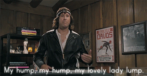
"'My Humps' - Black Eyed Peas"
"Apparently they were not just talking about milk and Cocoa Puffs."
- happygolucky226
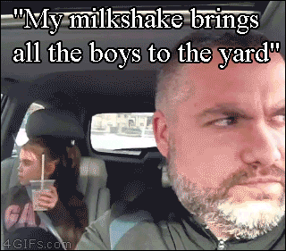
"No, that's that 'Milkshake' song [by Kelis]."
"She makes really good milkshakes, right?"
- CatOfGrey
 Giphy
Giphy"My cousin (4 at the time) loved singing the 'Milkshake' song."
"Then she and her sister were gently told not to sing it so they moved onto 'My Humps'!"
"I couldn’t bear hearing about lovely lady lumps, so I tried to find another song more appropriate."
"They settled on another Peas one 'Shut Up!'."
"Slightly more tolerable I guess, but there was no telling the girls to shut up because they’d just start repeating it back in song at you."
- 3rdslip
 Giphy
GiphyBut Uncle Luke was so subtle...
"'Me So Horny' by 2 Live Crew."
"My Dad once said 'It’s your mom’s favorite song'."
"Thanks Dad."
- Geriatric_Sloth
"When I was a kid, my little brother came into the room singing [from 'We Want Some P***y' by 2 Live Crew] 'Just nibble on my d*ck like a rat does cheese'."
"My mom in outrage said, 'what did you say!'"
"He calmly looked at her and spoke confidently, 'All I said was just nibble on my d*ck like a rat does cheese'."
"He was like 4 or 5 years old, that tape [Is What We Are by 2 Live Crew] was confiscated immediately."
- Tweedbreak
Uncle Luke of 2 Live Crew
GiphyAnd now for something completely different...
"In about 3rd or 4th grade I came home from playing at a friends house…said friend had been singing some weird song that got stuck in my head."
"So I stroll in and take my seat at the dinner table and start singing as loud as I can: 'Sit on my face and tell me that you love me! I’ll sit on your face and tell you that I love you too!!'…my parents damn near choked."
"They couldn’t stop laughing and then told me never ever to sing that again. Luckily they were huge Monty Python fans…nothing I knew about at the time."
- roygbiv_87
*WARNING: NSFW*
Ah, to be young and innocent again.
Did you learn anything new about what a song really means?
Or did you sing something as a child that didn't make the list?
Share your story in the comments.